
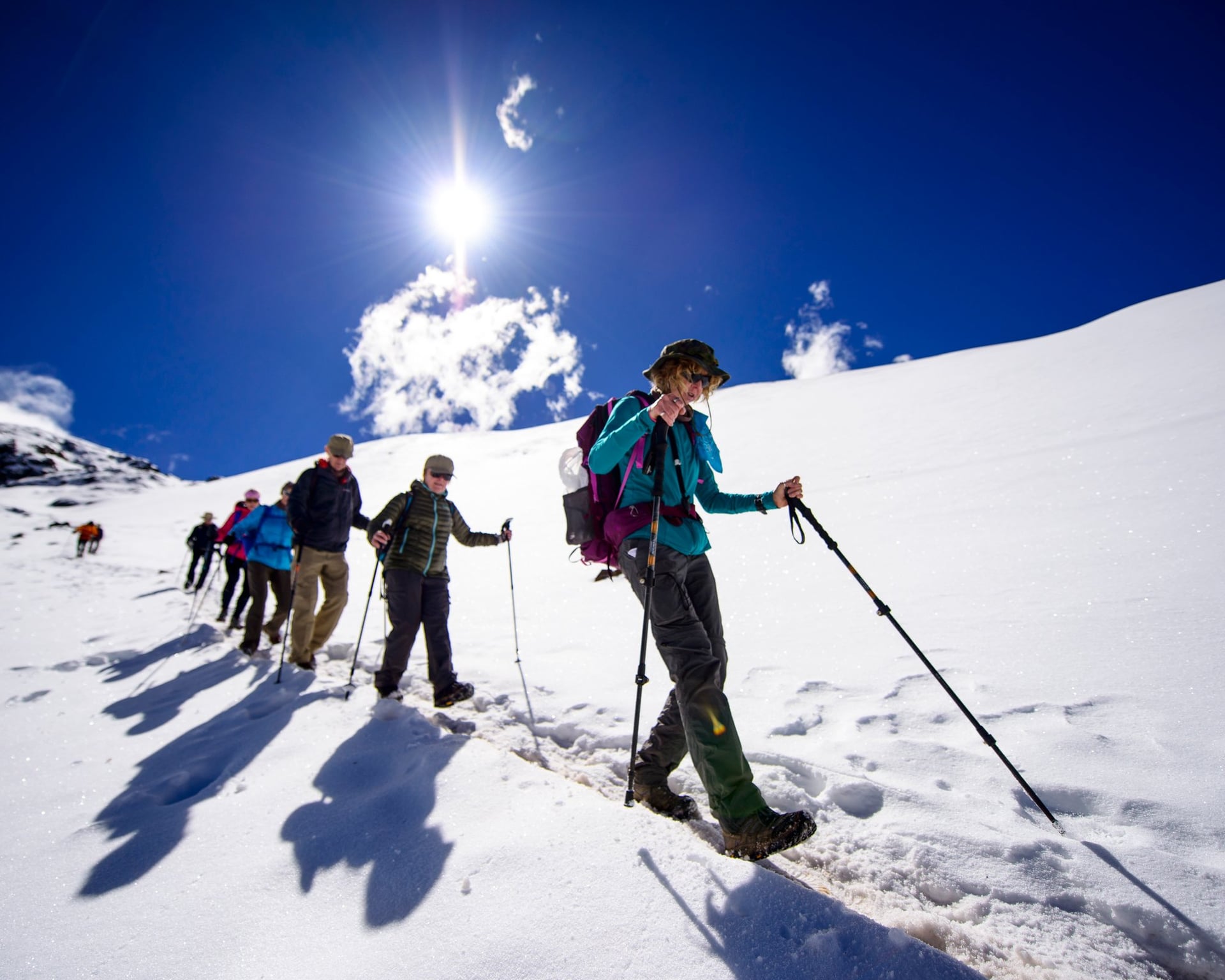
The stop-by-stop route around Ausangate, how many days it takes, how hard the altitude is, the best months to go, and how camping compares with sleeping in lodges
Ausangate is the highest mountain in the Cusco region of Peru, at 6,384 m (20,945 ft). For the Quechua communities living below it, it is considered an apu, a sacred mountain. The 52–70 km (32 to 43 mi) trail winds around glaciers, turquoise lakes, herds of alpacas, and mountain passes reaching over 5,000 m (16,400 ft). The classic circuit stays above 4,000 m (13,120 ft), with overnight stays starting at about 4,300 m (14,110 ft).
The Ausangate circuit stands out as one of the most challenging yet peaceful treks in the area. Without Inca ruins or advanced permit restrictions, it offers days of quiet hiking alongside local herders, pack horses, and grand glaciated peaks. Certain routes even allow you to experience Rainbow Mountain at dawn, well before the daily tour crowds arrive from Cusco.

Want to know which version of the trek fits you? PlanetaEXO, an ecotourism platform specializing in Peru trekking tours, has put together this guide to help you plan it. Check it out below!
Where is Ausangate?
Ausangate is located in the Cordillera Vilcanota, about 85 km (53 mi) in a straight line east-southeast of Cusco. Standing as the tallest mountain in the range and Peru’s fifth highest, Nevado Ausangate is revered in Quechua tradition as the main Apu, or sacred peak, safeguarding the entire Cusco region.
Each year around late May or June, tens of thousands of pilgrims make the journey to the sanctuary of Qoyllur Rit’i within the Sinakara Valley nearby, celebrating a vibrant festival recognized on UNESCO’s Intangible Cultural Heritage list.
Starting in the villages of Tinki and Upis (roughly a 3- to 4-hour drive from Cusco via Ocongate), the route winds through land largely stewarded by local herding communities, who raise llamas and alpacas on the high alpine pastures, manage the campsites and thermal baths, and handle the pack horses transporting gear.
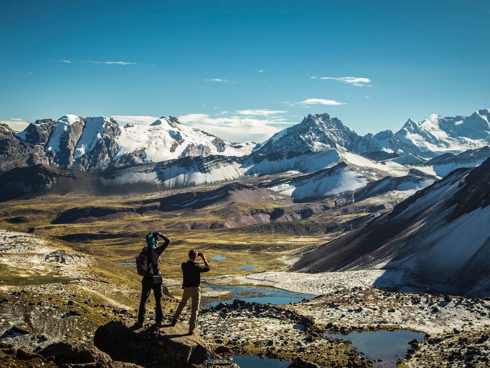


The surrounding landscape is Andes to its core: towering glaciers in every direction, mineral-rich colorful lakes, dramatic ochre and red ridges, and native wildlife ranging from vicuñas and vizcachas to Andean geese and soaring condors. If you want mountains and space, this is one of the best treks in Peru.
The Ausangate circuit, stop by stop
The Ausangate trek map below follows the classic route counterclockwise (the direction most groups walk). Altitudes are rounded.
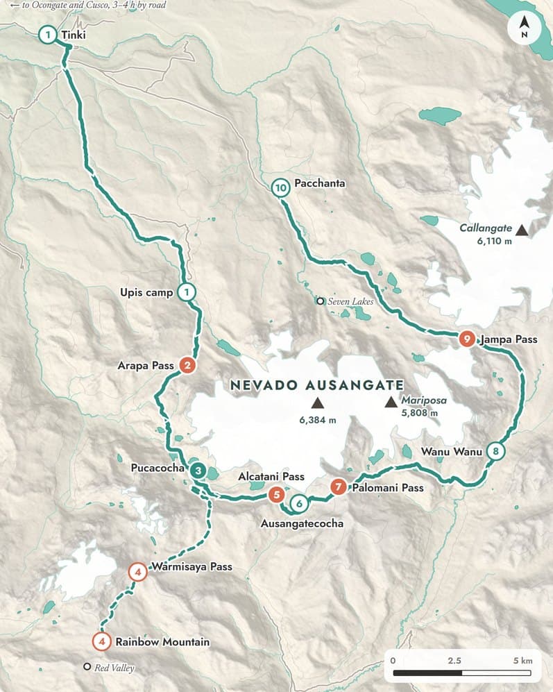
Tap a number, or slide along the line to read the altitude.
- on foot
- 52 km
- Palomani Pass
- 5,000+ m
- on the classic loop
- 4 passes
Trail © OpenStreetMap contributors, terrain from AWS Terrain Tiles. Stop altitudes rounded, as on the map.
- 1. Tinki and Upis, Upis camp at 4,400 m: Trailhead villages; camp below the north face, small hot springs
- 2. Arapa Pass, 4,670 to 4,800 m: First pass of the trek
- 3. Pucacocha, 4,575 m: Blue lake right below a glacier; you can hear the ice break
- 5. Alcatani Pass, 4,850 to 4,900 m: Last pass before Ausangatecocha on the classic camping route
- 6. Ausangatecocha, 4,650 m: Lake and campsite facing the glaciated south face
- 7. Palomani Pass, above 5,000 m: The high point of the circuit
- 8. Wanu Wanu, 4,450 to 4,600 m: Camp on a wide high pampa between the two highest passes
- 9. Jampa (Qampa) Pass, 4,950 to 5,060 m: Close view of the ice spires of Mount Callangate
- 10. Pacchanta, 4,300 m: End of the trek; public hot springs; the Seven Lakes above the village
Without Rainbow Mountain, the loop from Upis to Pacchanta is about 52 to 60 km (32 to 37 mi). With the detour to the colored mountain and the Red Valley, it grows to about 70 km (43 mi).
The section from Palomani Pass to Pacchanta, on the “back” of the mountain, is the one many travelers remember most. It is also the part that the shorter Rainbow Mountain treks skip, since they only walk past one side of Ausangate.


Rainbow Mountain on the Ausangate circuit: a stop, not the goal
Situated on the southern flank of Ausangate, Rainbow Mountain (Vinicunca) is typically visited via a lengthy single-day tour departing from Cusco. During peak season, thousands of day-trippers ascend the trail, with most arrivals usually in the late morning.
When you take a multi-day trek, things are different. By spending the night nearby, you can set out early and explore the vibrant ridges before the tourist buses arrive. A short 45-minute walk leads to the even more serene Red Valley. On lodge itineraries, travelers reach Vinicunca after three days in the mountains, with time for lunch and photographs before continuing.
Rainbow Mountain is a good stop on the way, but the reason to come is Ausangate itself: the glaciers, the lakes, and the long days with no one else on the trail.

How many days do you need to walk the Ausangate circuit?
Most itineraries take 4 to 7 days. The choice depends on what you want to see:
- 4 days: the core circuit from Upis to Pacchanta, without Rainbow Mountain. Long days, little margin.
- 5 days: the most common length. Either the full circle at a steady pace or a route that adds Rainbow Mountain.
- 6 to 7 days: the full circle plus Rainbow Mountain and the Red Valley, with shorter days and more time to adjust to the altitude.
For the camping experience, our 5-day Ausangate trek covers 52 km (32 mi) across four mountain passes from Upis to Pacchanta over four days of hiking. Alternatively, the Ausangate lodge-to-lodge trek spans the same 5 days along a distinct route via Rainbow Mountain and the Pitumarca Valley, offering comfortable accommodations each night.


How difficult is the Ausangate trek?
While the Ausangate hike involves no technical elements such as ropes, climbing, or exposed ledges, the high altitude is definitely a challenge. Overnight stays range from 4,300 to 4,850 m (14,110 to 15,910 ft), alongside several pass crossings near or exceeding 5,000 m (16,400 ft), with Palomani Pass being the highest point of the trek.
Since PlanetaEXO gives the Ausangate trek an advanced difficulty rating requiring prior mountain trekking experience, this trail is not recommended as a first multi-day hike.
Daily walking times run from 3 to 10 hours. A typical day starts with a wake-up call around 5:30 AM, a start at 6:30 AM, a long climb in the morning, and an afternoon at camp. The most demanding day is usually the one with the highest pass, or the day that adds Rainbow Mountain, which can take 10 hours.


Three habits make walking less difficult:
- Acclimatize first: spend at least 2 days (ideally 3 or 4) in Cusco or the Sacred Valley before the trek. Better still, walk Ausangate at the end of your trip, after another trek such as the Inca Trail or Salkantay, when your body is already used to the altitude.
- Walk slowly: short steps and a steady pace work better than speed at such high altitude.
- Let the horses carry the load: guided treks include horses to carry camp gear and everyone’s bags, allowing hikers to walk only with a daypack. Spare horses are also available for anyone who needs a rest.
Early signs of altitude sickness are usually headaches, loss of appetite, dizziness, and poor sleep. If you feel unwell, tell your guide right away, rest before going higher, and go down if the symptoms get worse. Before the trip, talk to your doctor about altitude sickness and medication.
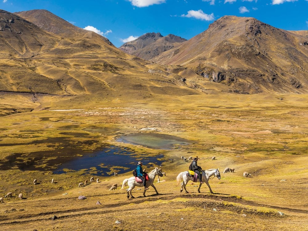
Best time to hike Ausangate and what the weather is like
The best months are the dry season, from May to September, with April and October as good shoulder months. PlanetaEXO’s group departures, both camping and lodges, run from April to October.
Dry does not mean mild. At this altitude, nights in camp can drop to about −10 °C (14 °F) from June to August. Hikers report hail and snow in the afternoon even in May and August, while the passes can be windy and cold. The days, on the other hand, are often sunny, with strong UV.
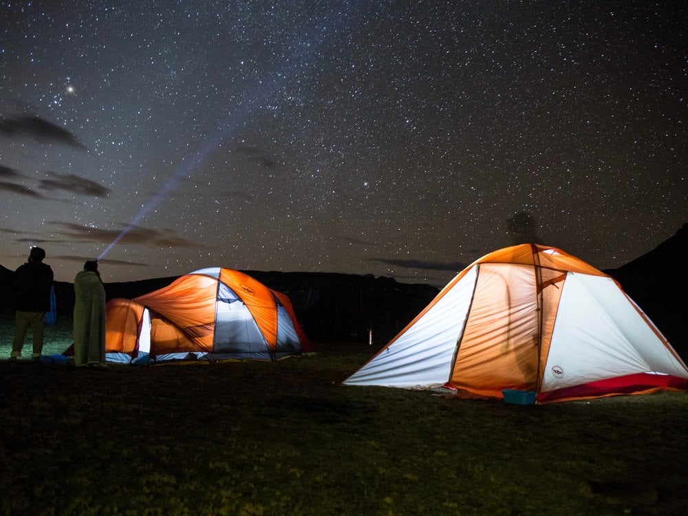
The rainy season runs from about November to March, with the heaviest rain in January and February. Snow can close the passes, fog hides the trail, and most groups do not walk the trek in those months.
What to pack for the cold:
- A sleeping bag rated 0°C to −15°C (32°F to 5°F) if you go camping.
- Warm layers, a down jacket, a beanie, and gloves.
- A rain jacket, plus rain pants in the shoulder months.
- Sunscreen, sunglasses, and a cap.
- A headlamp and trekking poles.
Camping or lodge to lodge: which Ausangate trek is for you?
This is the choice almost no guide compares side by side. Both options walk around the same mountain, but the experience at night is very different.
| CAMPING | LODGE TO LODGE | |
|---|---|---|
| PlanetaEXO trip | 5-day Ausangate trek | Ausangate lodge to lodge trek |
| Distance | 52 km (32 mi) over 4 hiking days | About 52 km (32 mi) over 5 hiking days. |
| Nights | 4 in double tents, about 4,290 to 4,643 m (14,070 to 15,230 ft) | 4 in mountain lodges, about 4,350 to 4,850 m (14,270 to 15,910 ft). |
| Bathroom | Camp toilets | Private bathroom with hot water. |
| Who carries your bag? | Horses | Llamas and horses. |
| Rainbow Mountain | Not on the route | Lunch stop on Day 4 |
| Best for | Hikers who want the classic circuit and wild camps | Hikers who want a bed, a warm room, and Rainbow Mountain. |
Camping follows the classic circuit from Upis: Arapa Pass, Pucacocha, Ausangatecocha, Palomani, and Jampa, ending at the Pacchanta hot springs. Just above the village lie the 7 lakes of Ausangate, a cluster of small glacial lakes worth the short climb if you have energy left. A cook prepares every meal in a kitchen tent, and you sleep facing the glaciers.
The lodge-to-lodge itinerary is one of the few ways to explore the Cordillera Vilcanota in true comfort. The hotels, managed by local communities, are situated a day’s hike apart and are equipped with beds, bathrooms, and thermal duvets. An excellent option for those seeking luxury tours in Peru!


Practical tips for the Ausangate trek
- No advance permit: unlike the Inca Trail, Ausangate does not require a permit booked months ahead. You can plan the trek a few weeks before your trip, outside the busiest dates.
- Carry cash in small notes: each community charges its own small fee in Peruvian soles—at the trailhead, some campsites, Rainbow Mountain, Red Valley, and hot springs. On a guided trip, most of these are included; check what is not.
- Expect fog on the passes: some hikers find the trail well marked, while others walk with GPS all the way. In fog or snow, paths split and disappear, and one wrong turn can cost you hours. A local guide knows the way and the community rules.
- Treat your water: streams cross pastures full of alpacas and horses. Filter or boil everything.
- No phone signal: most of the trail has little or no mobile coverage. The lodge trek team carries a satellite phone; if you hike on your own, carry a satellite messenger and leave your route with someone in Cusco.
- Insurance that covers altitude: choose a policy that covers trekking above 5,000 m (16,400 ft) and emergency evacuation. Some operators ask for proof before the trek.
- Bring a swimsuit: the hot springs at Pacchanta, at the end of the camping circuit, are the best reward after four days in the cold.
Planning your Ausangate trek with PlanetaEXO
Now that you know the route, the days and the altitude, it is time to choose your version of the Ausangate circuit: a classic camping trek around the sacred mountain, or a lodge-to-lodge walk with Rainbow Mountain on the way.
PlanetaEXO is an ecotourism platform specializing in Peru tours. We work with experienced local teams in the Andes and plan your acclimatization days in Cusco and the Sacred Valley around the trek. Contact us now!
FAQ about the Ausangate trek
How long is the Ausangate trek?
The core circuit from Upis to Pacchanta is about 52 to 60 km (32 to 37 mi), usually walked in 4 or 5 days. With the detour to Rainbow Mountain and the Red Valley, it grows to about 70 km (43 mi) over 5 to 7 days.
Our 5-day Ausangate trek covers 52 km (32 mi) over four hiking days, with transport from and back to Cusco on the first and last days.
How high is Ausangate?
Mount Ausangate is 6,384 m (20,945 ft) high, the highest peak in the Cusco region. The trek does not climb the summit, which is a technical mountaineering route. The trail itself reaches its high point at Palomani Pass, above 5,000 m (16,400 ft), and never drops below about 4,100 m (13,450 ft) on the classic circuit.
Is the Ausangate trek harder than the Inca Trail or Salkantay?
For most hikers, yes. The daily distances are similar, but you sleep higher every night, between about 4,300 and 4,850 m (14,110 and 15,910 ft), and you cross more passes close to 5,000 m (16,400 ft). That is why many travelers do Ausangate after another trek, when they are already used to the altitude.
Can you hike Ausangate without a guide?
Some experienced hikers do it on their own, carrying a tent, food, and a GPS tracker. It is possible, but you need to be self-sufficient above 4,500 m (14,760 ft) for several days, find the trail in fog or snow, and pay the community fees on the way.
With a guide, horses carry the camp, the cook handles the meals, and the team knows the route and the communities. On PlanetaEXO’s lodge trek, the team also carries oxygen, a portable hyperbaric chamber, and a satellite phone.
When is the best time to hike Ausangate?
From May to September, in the dry season, with April and October as shoulder months. Expect freezing nights from June to August and the chance of snow at any time.
Avoid January and February, the rainiest months, when most groups do not walk the trek. The lodges stay closed from January to early March.
Does the Ausangate trek go to Rainbow Mountain?
It depends on the route. The classic camping circuit stays on the Ausangate side and skips it, while some longer or lodge routes include Rainbow Mountain as a stop.
Keep reading
November 11, 2026
The Inca Trail to Machu Picchu: Permits, Route, Difficulty, and When to Go
Plan the Inca Trail to Machu Picchu: how permits work and when they sell out, the route day by day, how hard it is, and the best months to go!
November 7, 2026
How to Hike the Salkantay Trail to Machu Picchu in Peru – Travel Guide
Plan your Salkantay Trail hike to Machu Picchu in Peru, with the route, Humantay Lake, high pass, best season, days, where to sleep, and Salkantay vs Inca Trail!
November 4, 2026
10 Facts About Salkantay Mountain, the Sacred Peak on the Way to Machu Picchu
A sacred Andean apu, South America’s only bear, breathtaking glaciers, and a hidden view of Machu Picchu. Learn 10 facts about Salkantay Mountain!