
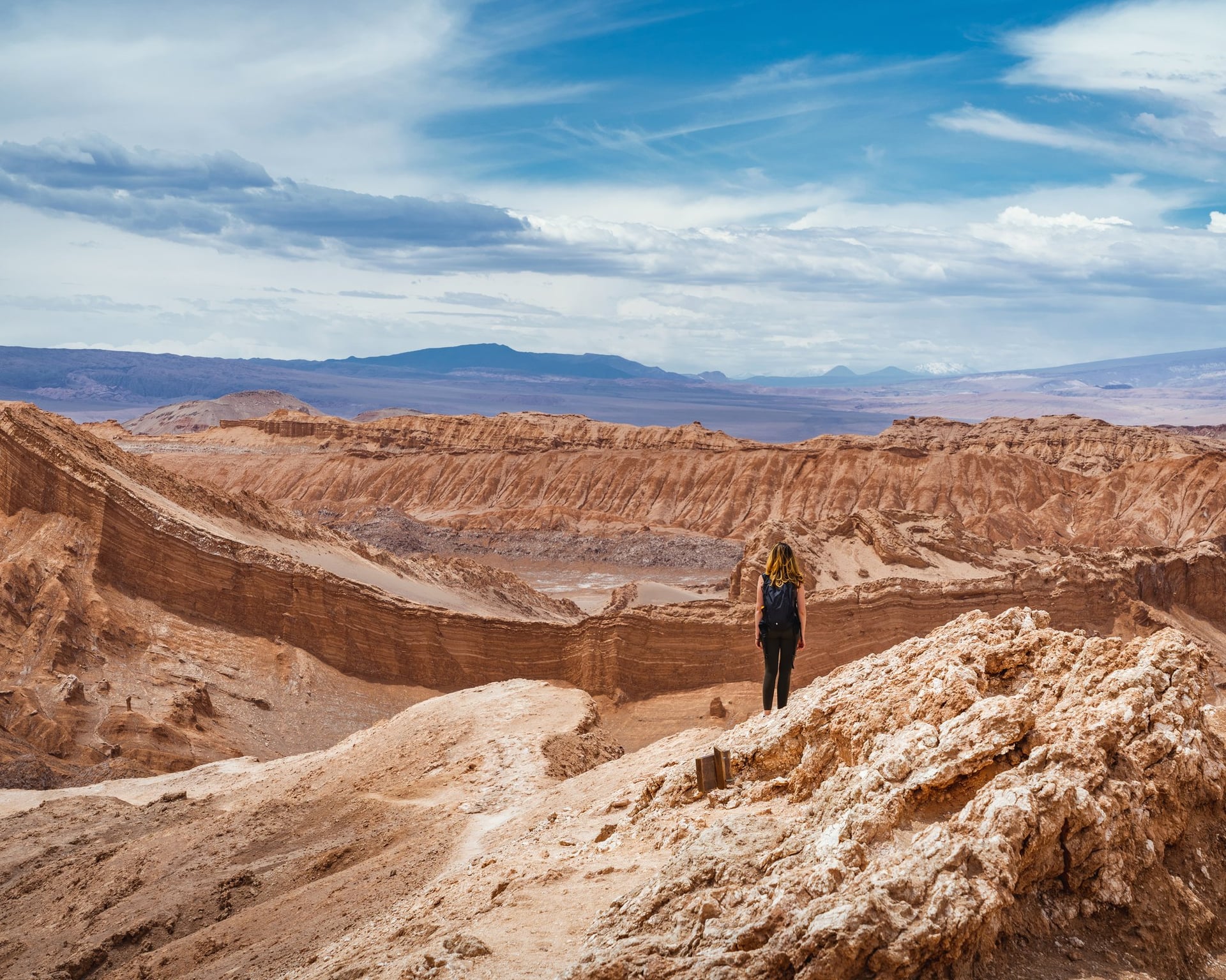
A practical Atacama Desert travel guide: how to reach San Pedro de Atacama, what each classic trip involves, ticket prices, and how to handle the altitude
The Atacama Desert covers a long strip of northern Chile between the Pacific and the Andes, often called the driest desert in the world. San Pedro de Atacama, the small adobe town where almost every trip starts, gets very little rain and more than 300 clear days, sitting at about 2,400 m (7,900 ft).
That mix of altitude, dry air, and dark skies is what brings people here: geysers at sunrise, flamingos on the salt flats, red rocks next to turquoise lagoons, and some of the clearest night skies on the planet.

Want to know all about this fantastic place before you go? PlanetaEXO, an ecotourism platform specializing in Atacama Desert tours, has put together this travel guide with everything you need to plan your trip. Check it out below!
Where is the Atacama Desert?
The Atacama Desert is in northern Chile, on the Pacific coast of South America. It runs from the border with Peru south to the area around Copiapó, squeezed between the ocean and the Andes. It covers most of four Chilean regions: Arica y Parinacota, Tarapacá, Antofagasta, and Atacama.
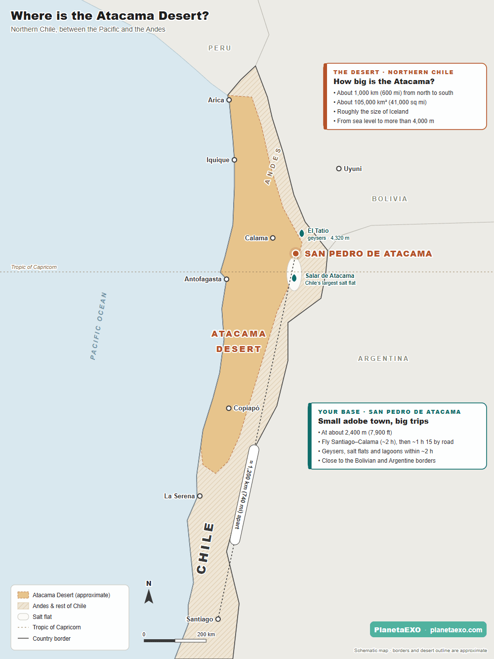
From north to south, the desert measures 1,000 km (600 mi). In fact, some sources stretch it to 1,600 km (1,000 mi) by counting the narrow coastal strip that reaches toward La Serena. It covers about 105,000 km² (41,000 mi²), or 128,000 km² (49,000 mi²) if you add the bare lower slopes of the Andes, roughly the size of Iceland or the US state of Kentucky.
San Pedro de Atacama: your base in the desert
San Pedro, the seat of a 23,439 km² (9,050 mi²) commune, is a town of adobe houses, a whitewashed church, and one busy main street, Caracoles, lined with tour agencies, restaurants, and small shops. Almost every tour in this guide is a return trip from here.
A few things are worth knowing before you arrive:
- Money: ATMs are few and often run out of cash, so bring some Chilean pesos from Calama or Santiago. Cards are widely accepted in town; some sites take cards only, but smaller sites charge in cash.
- Signal: outside town there is little or no mobile coverage. Download offline maps and your tickets before you leave.
- Fuel: the only gas station in the area is in San Pedro, so fill up before every long trip if you drive.
- Prices: accommodation is expensive. In general, it costs 25% to 35% above Santiago.
- Health: San Pedro has only a primary-care health center, and the nearest hospital is in Calama, about 100 km away. One more reason to take the altitude seriously and travel with good insurance.
- Hotel tax: foreign tourists who pay for their room in US dollars (cash or a foreign card) and show their passport and PDI tourist card do not pay Chile’s 19% VAT on lodging. Tours are not covered.


How to get to San Pedro de Atacama?
San Pedro de Atacama sits on the desert’s eastern edge, in the Antofagasta Region, close to where Chile meets Bolivia and Argentina. It is more than 1,600 km (1,000 mi) north of Santiago by road, which is why almost everyone flies to Calama.
The usual route is a flight from Santiago (SCL) to Calama (CJC) and then about 1 hour 15 minutes by road on Route 23. Nonstop flights from Santiago take about 2 hours; LATAM, Sky and JetSMART fly the route every day.
Shared transfers and intercity buses leave from the airport. All PlanetaEXO trips include the transfers from and to Calama Airport, which makes logistics way more convenient.
There are two other ways in. By bus from Santiago, the trip takes close to 24 hours, and from Antofagasta, 310 km (192 mi) away, between 3h40 and 5 hours.
Atacama Desert altitude: how to acclimatize?
San Pedro sits at about 2,400 m (7,874 ft), Laguna Chaxa at 2,300 (7,545 ft), and the altiplanic lagoons and El Tatio at more than 4,000 (13,123 ft).
Altitude is the main health issue on this trip. On high tours, travelers describe a racing heart, headaches, and dizziness. To prevent these symptoms—or at least minimize them—follow the recommendations below:
- Spend one or two days at San Pedro’s altitude before going above 4,000 m.
- Plan a low-key first day. Go from the lowest places to the highest, and leave El Tatio for your last morning.
- Walk slowly up high, drink plenty of water, and use lip balm, saline spray, and moisturizer—the air is extremely dry.
- If you get a strong headache, nausea, or dizziness, tell your guide and do not go higher; serious symptoms need a doctor and a descent.
- Check that your travel insurance covers trips above 3,000 m (9,842 ft).

What is the best time to visit the Atacama Desert?
While it is possible to visit the Atacama Desert year-round, each season offers a different experience. The high season, which is warmer, runs from December to February—months that also coincide with the “Altiplano winter,” when humidity from the Amazon brings afternoon rains to the high plateau.
If you plan on camping, the window between October and March is recommended, as the nights are milder during these months. Due to the low temperatures between April and September, camping is not advised during that time.
It is also worth noting that the Atacama Desert and San Pedro de Atacama have different climatic conditions. See the main differences below:
| ATACAMA DESERT(THE WHOLE REGION) | SAN PEDRO DE ATACAMA (THE OASIS TOWN) | |
|---|---|---|
| Climate | Changes by zone: mild, humid coast; bone-dry interior; freezing high plateau. | One pattern: dry, high-altitude desert. |
| Daytime | About 15–25°C (59–77°F) on the coast, often below 10°C (50°F) on the high plateau. | About 13–25°C (55–77°F), with highs up to 32°C (90°F). |
| Night and dawn | Down to about −15°C (5°F) on the high plateau (El Tatio, winter). | Cold and often windy, coldest from June to August. |
| Day–night swing | Small on the coast, huge inland. | Large: warm, sunny days and cold nights. |
| Rain | Almost none in the core, the driest place on Earth. | Very little, mostly between January and March. |
| Typical weather | Coastal fog (camanchaca); snow and storms on the high plateau. | The altiplanic winter (January–March, sometimes April) can close parks such as the Moon Valley. |
| Humidity and UV | Humid coast, extremely dry interior. | Very low humidity, strong UV. |
| For visitors | Always check which zone a forecast is for. | The town forecast is misleading: most tours climb above 4,000 m (13,123 ft). |


The best things to do in the Atacama Desert
The list below follows the order most local guides recommend: from the lowest places to the highest, so your body adapts as you go.
There is no single park ticket. The Atacama Desert is a patchwork of areas run by the local Atacameño (Lickanantay) communities, some of them together with CONAF (Chile’s National Forest Corporation). Each area charges its own entrance.
Several of the best-known sites, including Valle de la Luna, Laguna Chaxa, and the Miscanti and Miñiques lagoons, are sectors of the Los Flamencos National Reserve, created in 1990.
Valle de la Luna (Moon Valley)
Located within the Cordillera de la Sal, Valle de la Luna is the most iconic attraction in the Atacama Desert, featuring striking sand dunes, canyons, and formations of salt, clay, and stone, all sculpted over millions of years by the wind and temperature fluctuations.
Standard group tours usually depart around 2 to 3 PM—right during the hottest hours and harshest light—and the site closes roughly an hour before sunset for most months. For the sunset itself, travelers head to the free Mirador Licancabur along the highway or access Piedra del Coyote with their pass.
Visitors on foot are not allowed in, so you need a car or bike. The drive takes about an hour, plus a few walks. Cyclists may enter between 9 and 11 AM if wearing a helmet, though schedules shift across seasons.

Salar de Atacama and Laguna Chaxa
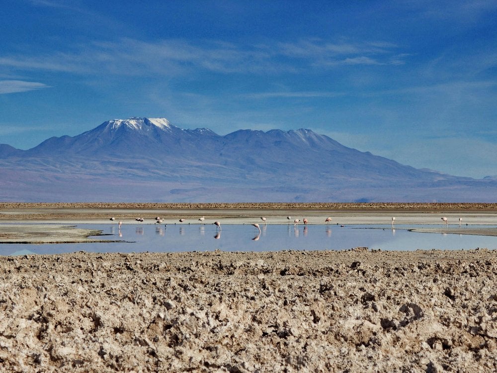
The Salar de Atacama is the largest salt flat in Chile, and Laguna Chaxa, at about 2,300 meters (7,545 ft), is where you see its flamingos up close. An interpretation trail leads to the water, where all three altiplano species feed—the Andean, Chilean, and James’s flamingos.
Most salt-flat tours continue to Toconao, a village of white volcanic stone with an 18th-century bell tower, about 40 km south of San Pedro, and end in the Jerez gorge, a green strip of orchards along a stream in the middle of the desert.
Laguna Cejar, Ojos del Salar, and Laguna Tebinquiche
High salt concentration in Laguna Cejar lets you float effortlessly in vibrant turquoise waters. While travelers often plan to swim here, the main lake remains off-limits for environmental conservation; guests enter neighboring Laguna Piedra instead.
Ojos del Salar are two circular freshwater lagoons located in the middle of the salt flat. Swimming rules here have changed over the years, so check the signs on site; most people simply admire them, given the extremely low water temperature and the depth.
Laguna Tebinquiche, on the other hand, is a shallow lagoon with clear, mirror-like water that reflects the sky and the volcanoes. Swimming and walking directly within its area are not allowed.

The altiplanic lagoons and Piedras Rojas
At an altitude of over 4,100 m (13,451 ft), in the Los Flamencos National Reserve, the altiplanic lagoons of Miscanti and Miñiques are striking for their turquoise-blue waters. They were once a single lake, but a lava flow from the Miñiques volcano split them thousands of years ago.
Nearby lies Piedras Rojas, a salt flat surrounded by vivid red rocks—colored by the oxidation of minerals such as iron and copper—and turquoise water.
Start your day early: smooth morning waters turn the lagoons into perfect mirrors before afternoon winds pick up. Along the road, you will pass the Tropic of Capricorn, where it’s common to spot vicuñas and guanacos roaming near the highway.
Many tours finish in Socaire, an Andean village at about 3,300 m (10,800 ft) with pre-Hispanic farming terraces and a colonial adobe church.
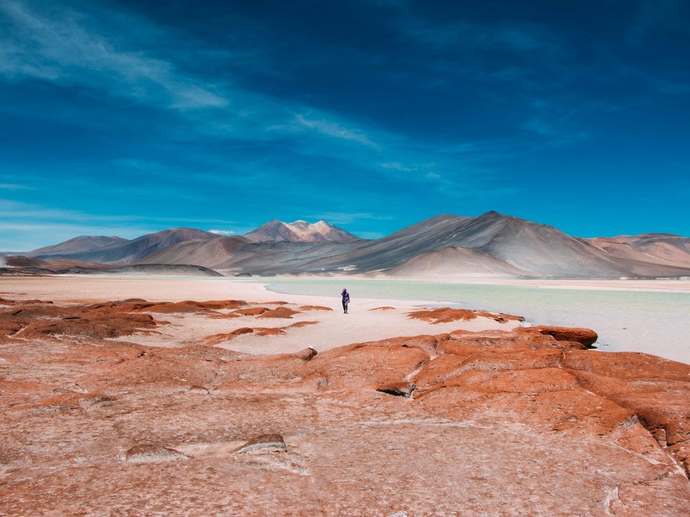


👉 Explore the adventure: Atacama Desert Tour Package: 4 Days from Moon Valley to El Tatio
El Tatio geysers
El Tatio is the third-largest geyser field in the world and the largest in the Southern Hemisphere, with about 80 active geysers at 4,320 m (14,170 ft). Its name is usually translated as “the grandfather who cries”.
The 2-hour journey along a dirt road departs from San Pedro starting at 4 AM. This timing ensures you arrive at El Tatio around sunrise, when the cold air turns the steam into tall, white columns. In fact, this is the coldest morning of any trip to the Atacama Desert, with average temperatures of about -8°C (17°F) in April and -10°C (14°F) in June.
As sunshine warms the field, the steam gradually fades, and most tour vans depart by 10 AM. That’s why some independent travelers choose to arrive after 9 AM to enjoy the boardwalks with far fewer crowds.

Follow the rules at the El Tatio geysers:
- Stay on the marked paths—the water is close to boiling.
- Pregnant women and young children are not allowed in; the minimum age varies by operator (usually 8 to 10).
- People over 70 are not allowed in either; some operators accept them with a medical certificate, so check before booking.
- To preserve the site, bathing in the geothermal pool is prohibited.
On the way back, most trips stop at Machuca, a small Atacameño village where you can try llama skewers and goat-cheese empanadas. If you want to enrich the experience, add the Termas de Puritama hot springs to your itinerary, about 30 km from town, with pools of 25 to 33°C (77 to 91°F).
Before reaching Machuca, the route passes through the Putana wetlands, a great spot to watch grazing vicuñas along with giant coots and Andean geese. Lower down, near the confluence of the Purifica and Puritama rivers, select tours hike Cactus Valley to admire 6-meter-tall (20 ft) cardón cacti.
👉 Explore the adventure: 5-Day Atacama Tour: Stargazing, Geysers, and Lickanantay Culture
Valle del Arcoíris and the quieter side of the desert
Valle del Arcoíris (Rainbow Valley) features mountains that display vibrant shades of red, green, yellow, white, orange, and gray—colors resulting from a mixture of clay, gypsum, iron, copper, and sulfur. Nearby lie the petroglyphs of Yerbas Buenas, hundreds of rock carvings left over the centuries by the peoples who traversed the desert, including the Lickanantay (Atacameños).
Our 7-day Atacama Desert Trek crosses this terrain over five hiking days, spanning 65.5 km (40.7 mi) and reaching up to 4,267 m (14,000 ft). Alternatively, our camping trip takes you off the beaten path with two campsite overnights in Machuca and Cactus Valley.
The camping tour starts closer to town, with a bike ride up the Catarpe Valley to the Garganta del Diablo (Devil’s Throat), a narrow canyon between walls of clay and salt. It also makes an easy half day on a rented bike, with a small entrance fee paid to the Catarpe community.

Atacama Desert stargazing
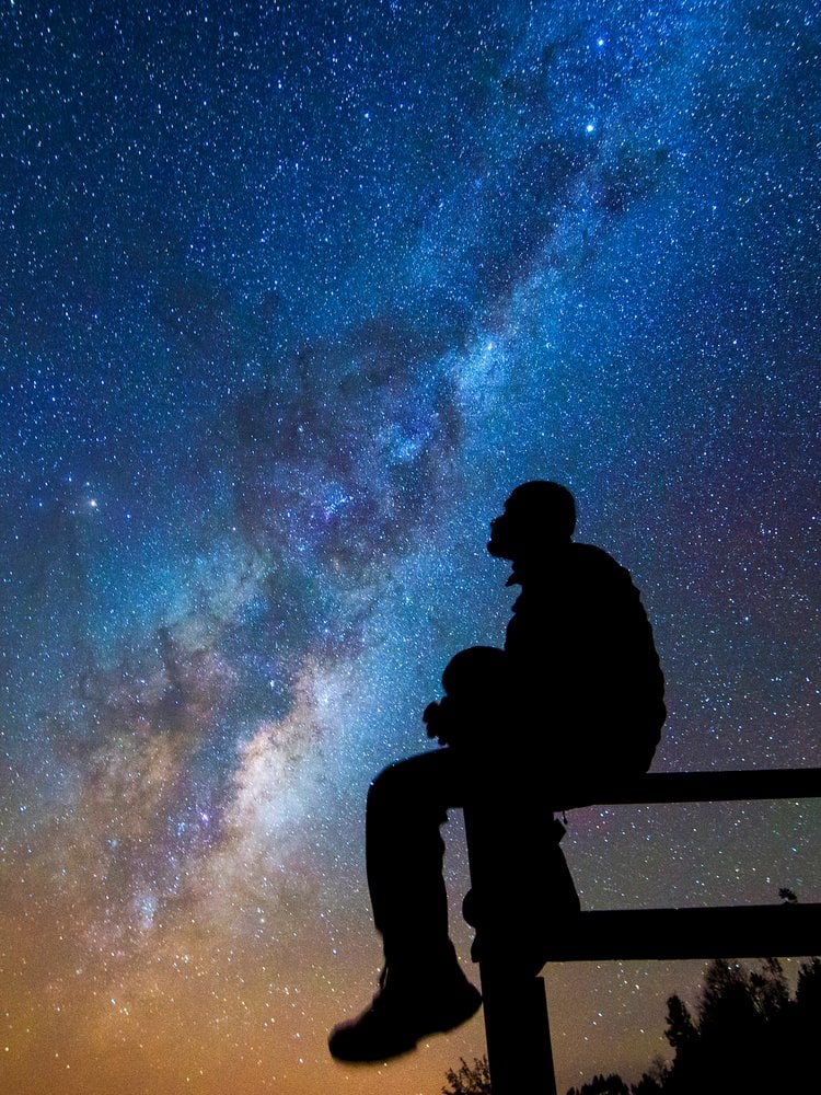
Taking in the night sky is widely considered one of the top things to do in the Atacama Desert. The extraordinary clear skies here come down to three main reasons: elevated altitude, remarkably dry air, and virtually zero light pollution.
Thanks to these conditions, the Atacama already holds about a third of the world’s optical telescope capacity, a share set to pass half as new giant telescopes come online, with San Pedro offering dozens of stargazing tours.
A regular excursion walks you through the visible constellations, points out the Moon, planets, and deep-space targets through high-powered telescopes, serves warm drinks, and captures a photograph under the stars. Guides ask visitors to put away phones so everyone keeps their natural night vision.
If you want to go stargazing in the Atacama, plan your trip according to the lunar calendar: the new moon and the crescent phases are the best times, while the full moon washes out the sky. Tours often fill up a week in advance, so book as early as possible.


Atacama Desert ticket prices
In San Pedro de Atacama, almost every tourist attraction charges its own separate entrance fee. Most of these sites are managed by Lickanantay indigenous communities in partnership with the Chilean authorities. The revenue collected funds the conservation of fragile ecosystems, helps manage visitor flow, and generates income for local communities.
Not all entrance fees are included in travel packages; tourists are usually responsible for purchasing tickets at the site entrance or providing the necessary funds to their guide. Prices tend to be higher for foreigners, with discounts available for children, students, and seniors.
Smaller community sites still charge in cash, using Chilean pesos. Bigger sites now sell online and take cards, starting with Valle de la Luna, where tickets must be purchased online in advance.
| PLACE | ADULT TICKET (2026) | WHERE TO BUY | PAYMENT |
|---|---|---|---|
| Valle de la Luna (Moon Valley) | CLP 10,800 | Online | Card |
| Laguna Cejar and Laguna Piedra | CLP 15,000 | Online, timed slot | Card |
| Laguna Chaxa (Salar de Atacama) | CLP 13,714 (foreign visitors) | Online | Card |
| Piedras Rojas + Miscanti and Miñiques | CLP 13,000 (foreign visitors) | Online, check-in at Socaire | Card |
| El Tatio geysers | CLP 15,000 | At the entrance | Check before you go (some operators report cash only) |
| Termas de Puritama | CLP 38,000 | Online | Card |
| Lagunas Escondidas de Baltinache | CLP 12,000 | On site | Cash |
| Laguna Tebinquiche | CLP 6,000 | On site | Cash |
| Valle del Arcoíris (Rainbow Valley) | CLP 5,000 | On site | Cash |
Prices change often and are set by each community. Check the official sales information of each site before you go.
On PlanetaEXO’s 4-day and 5-day Atacama tours, the entrance fees for the main sites are already included in the price:
- 4-day tour: Valle de la Luna, Laguna Chaxa, and the Jerez Valley; Puritama; Piedras Rojas with the Miscanti and Miñiques lagoons; and El Tatio. If you swap Puritama for Laguna Cejar and Tebinquiche, those tickets are included as well.
- 5-day tour: Valle de la Luna, Piedras Rojas with Miscanti and Miñiques, El Tatio, and the Lickanantay cultural experience.
On the camping trip, the only fee confirmed in writing is for Catarpe, for the bike ride to the Garganta del Diablo. On the 7-day trek, fees are included only under the local operator’s general terms. For both trips, check with us before you book.

How many days do you need in San Pedro de Atacama?
To make the most of your trip, aim for 4 to 5 days. This gives you an initial day to acclimatize before tackling one major excursion daily—such as the salt flat, high-altitude lagoons, or El Tatio geysers—while leaving evenings free for stargazing or exploring Valle de la Luna.
Though 3 days is the absolute minimum, extending your stay to 7 days allows time for Rainbow Valley, cycling, or climbing a volcano.
We structure our itineraries like this:
- 4-day itinerary: begins with Valle de la Luna upon arrival. Day 2 covers the salt flat, followed by Piedras Rojas, the altiplanic lagoons, and evening stargazing on Day 3. The trip concludes with an early morning visit to El Tatio.
- 5-day itinerary: starts with night sky observation and replaces the salt flat visit with an immersive Lickanantay cultural tour, including desert herb lore, traditional pottery, and llama trekking.
- Trekking & camping tours: for those who prefer exploring on foot, our 7-day trek and camping tours navigate the same desert landscapes.

What to pack for the Atacama Desert?
- Layers for 30 degrees of difference: a down jacket, hat, and gloves for El Tatio and stargazing, plus light clothes for the afternoons.
- Sun protection: category 3 or 4 sunglasses, a hat, and sunscreen.
- For Laguna Piedra and Puritama: swimsuit, towel, and sandals.
- To fight the dry air: lip balm, moisturizer, and saline spray.
- For the sites that take cash only: Chilean pesos.

Ready to visit the Atacama Desert? Plan your trip with PlanetaEXO!
Now that you know how San Pedro, the geysers, the salt flats, and the night sky fit together in the Atacama Desert, it’s time to plan your trip!
PlanetaEXO is an ecotourism platform specializing in Chile adventure tours. We work with local operators in San Pedro de Atacama and take care of all the logistics, so all you have to do is enjoy yourself. Contact us now!
Keep reading
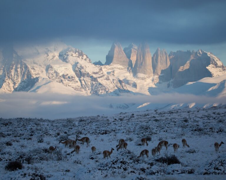
November 5, 2026
Best Time to Visit Patagonia: Torres del Paine Month by Month
The best time to visit Torres del Paine in Chilean Patagonia, month by month, with daylight, temperatures, wind, and park rules for the W and O treks.
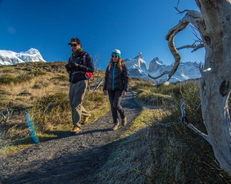
November 8, 2026
8 Best Torres del Paine Hikes, from Short Viewpoints to the W and O Treks
Discover the best Torres del Paine hikes in Chilean Patagonia. See real distances, times, cut-off hours, and the booking rules for the W and the O circuits!
November 13, 2026
Puerto Maldonado vs. Iquitos: Which Is Better for Your Amazon Trip in Peru?
Puerto Maldonado or Iquitos? Compare wildlife, jungle lodges, river cruises, costs, and travel times to choose the best Peruvian Amazon trip for you!